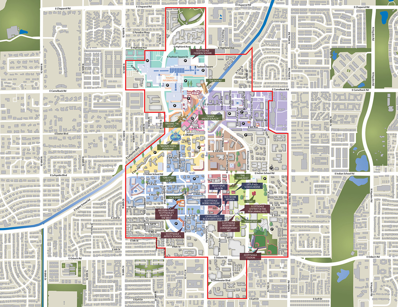
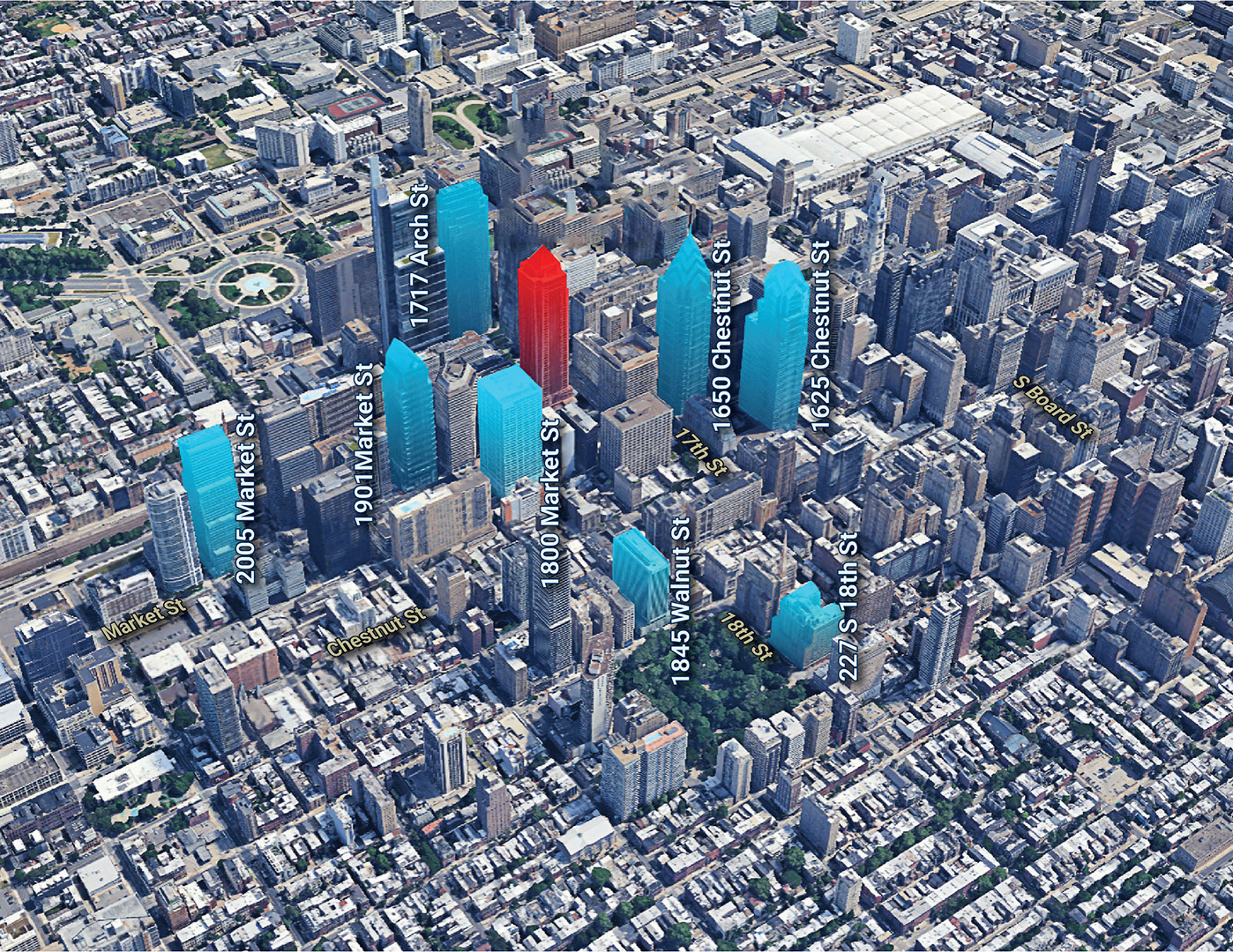
Aerial Markup #1
Aerial Markup #2
Aerial Markup #3
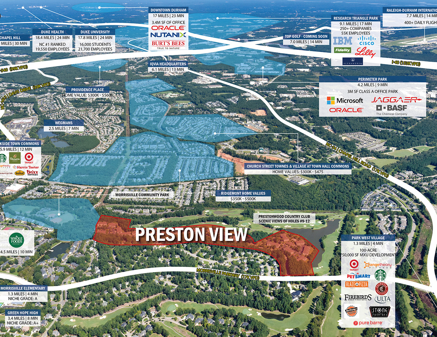
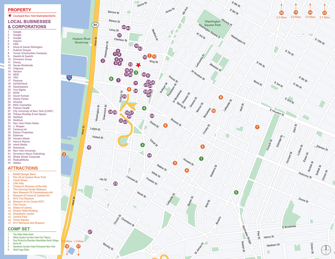
Competitive Aerial Map
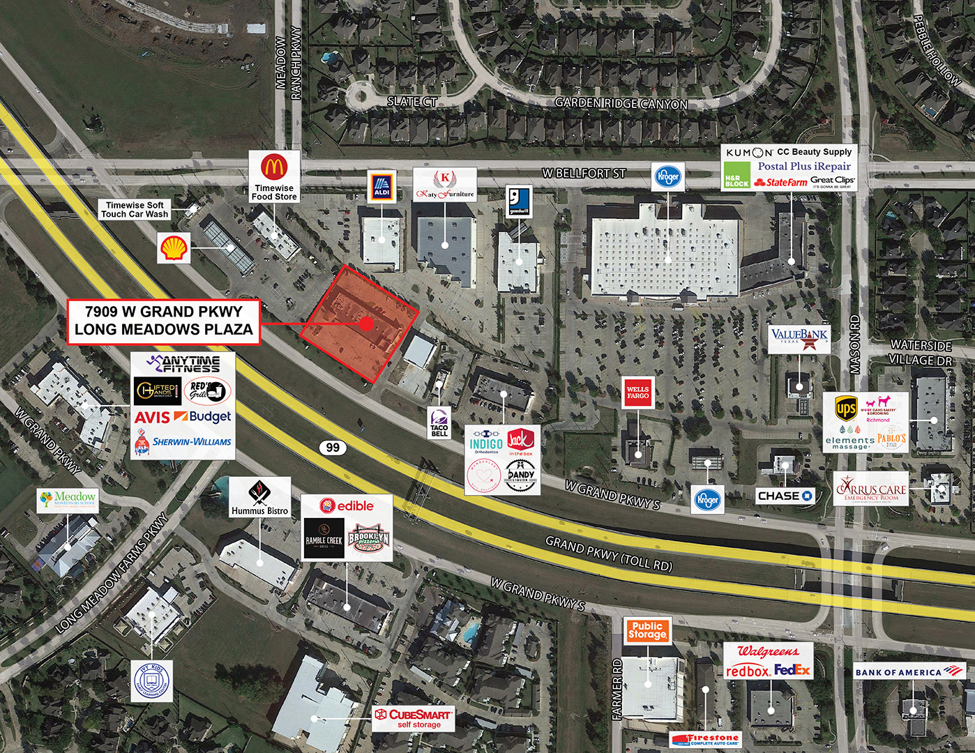
Building Detail Map
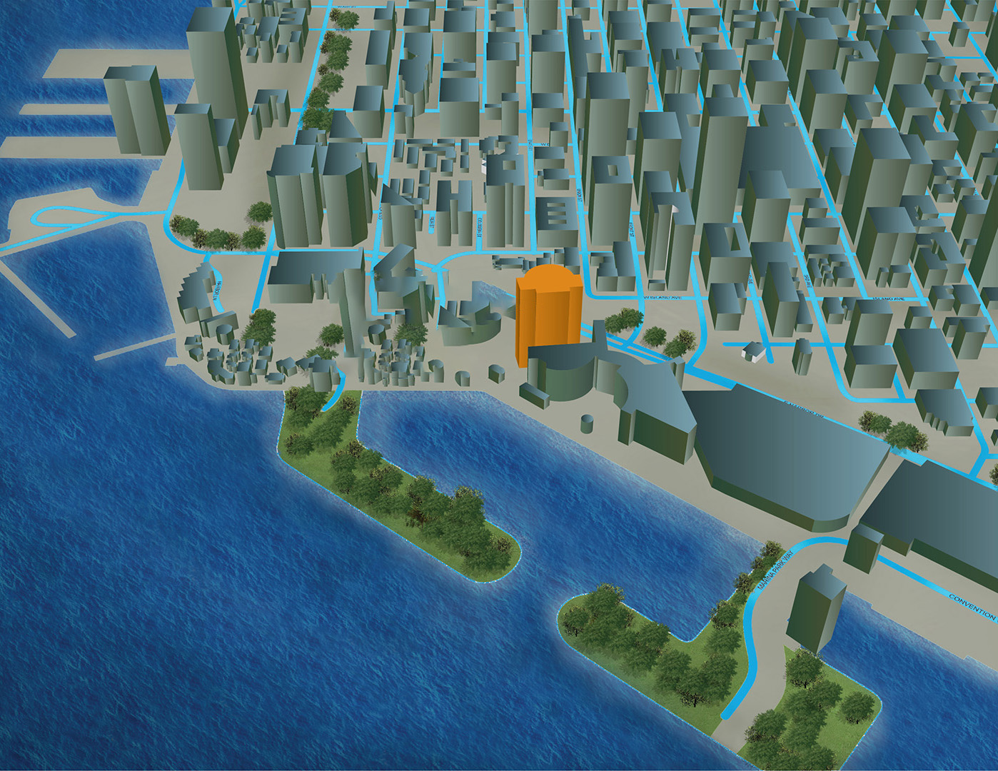
Building Detail Map 3D
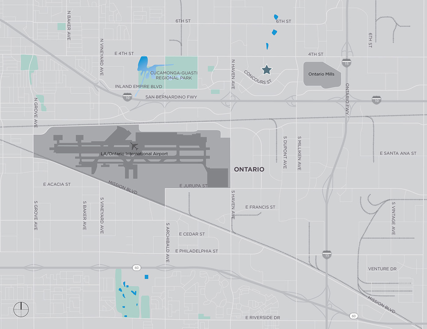
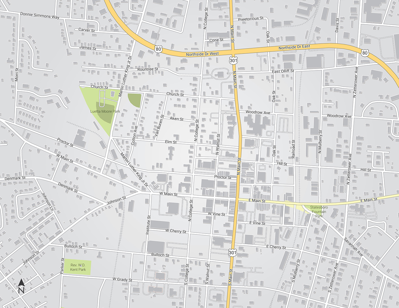
Basic Location Map

Detailed Map #1
Detailed Map #2

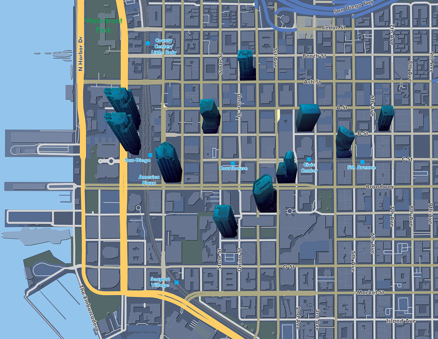
Competitive Map
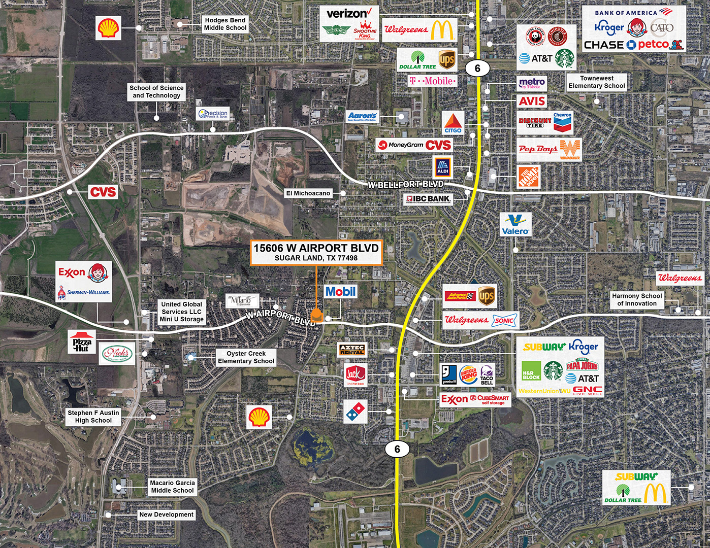
Building Detail Map #1